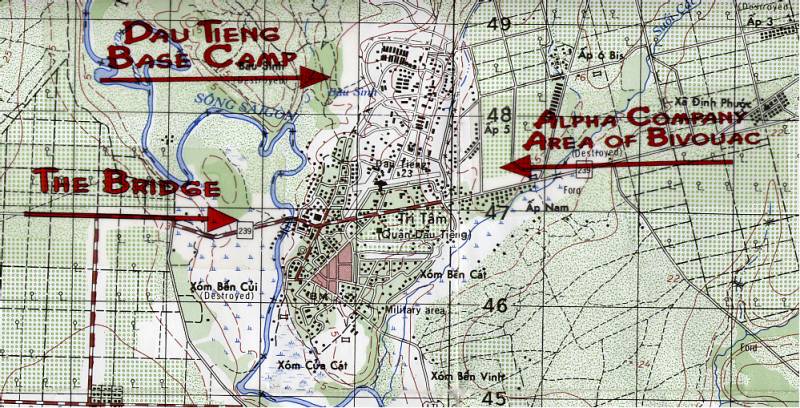
Map showing area around base camp
Note the A/2/12 bivouac area. just south of the tree line we built the bunkers that are shown in the pictures that Donald sent home. just below that 47 grid marker was a rice paddy that was fed by a river which branched off of the Saigon River further to the south. This would have put the rice paddy to his back as he shot that picture that day.
Note the bridge where Donald Evans took his photo. The Saigon River ran under that bridge in it's way south. highway 239 was the main route into the michelin rubber plantation. although nothing more than a two lane dirt road, it was nonetheless essential to the area.